TL;DR

Get everyday essentials delivered free with Prime
- Fast, free delivery on millions of items
- Prime Video, Amazon Music and more included
- Member-only deals all year
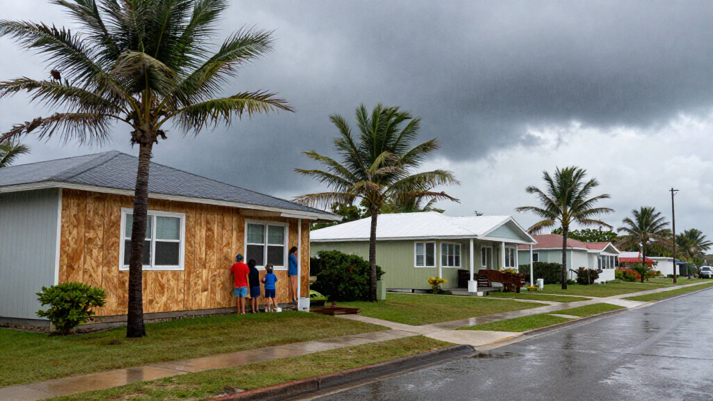
The National Weather Service office in Tallahassee issued an updated Hurricane Warning for South Walton, including Santa Rosa Beach, Sandestin and Freeport, at 8:28 a.m. EDT on Oct. 9. Its bulletin warned of potential hurricane-force winds, storm surge of 6–9 feet above ground in surge-prone areas and additional heavy rain; the alert was set to expire at 4:30 p.m. EDT, with conditions and warning status subject to further updates.
The National Weather Service office in Tallahassee issued an updated Hurricane Warning for South Walton at 8:28 a.m. EDT on Oct. 9, naming Santa Rosa Beach, Sandestin and Freeport among the affected locations. The alert warned of potentially life-threatening wind and storm surge, along with additional heavy rain, and urged people in the area to shelter and follow local emergency instructions.
The bulletin forecast a peak wind range of 45 to 60 mph, with gusts up to 85 mph, describing the latest local forecast as equivalent to strong tropical-storm-force wind. It said tropical-storm-force conditions could begin early that afternoon and continue until early Saturday morning. Separately, the warning described a potential wind threat of 74 to 110 mph, with the plan calling for residents to prepare for life-threatening wind equivalent to Category 1 or 2 hurricane force. The wind threat was described as nearly steady compared with the previous assessment.
For surge-prone areas, the forecast gave a potential peak storm-surge inundation of 6 to 9 feet above ground, with concern continuing through Saturday morning. The notice said the surge threat had also remained nearly steady from the prior assessment. It advised that ordered evacuations should be complete and that evacuees should be in shelters away from surge flooding; people already in safe locations were told to remain sheltered and avoid going outside.
A Flood Watch was in effect, and the bulletin forecast an additional 3 to 6 inches of rain, with locally higher amounts. It warned that major rainfall flooding was possible, including rapidly rising streams and rivers and water covering escape routes. The alert categorized the rain-flooding impacts as extensive and said evacuations and rescues could be needed. These are forecast threats and possible impacts, not confirmation that every listed effect had already occurred.
Immediate Risks Across South Walton
The warning covers a combination of hazards that can affect residents and visitors in different ways: damaging winds, coastal inundation and inland flooding. Surge can make low-lying and coastal areas dangerous even where rain totals are not highest, while heavy rainfall may flood roads and cut off routes away from rising water. The bulletin’s forecast ranges signal that conditions could vary across the warned area; they should not be read as a guarantee that every location will experience the peak values.
The timing also matters. The NWS forecast put the onset of tropical-storm-force winds in the early afternoon and continued the wind window into early Saturday, while the stated surge concern extended through Saturday morning. Residents deciding whether to travel, shelter or comply with evacuation orders should use current local emergency guidance rather than assume the warning’s issue time marks the start or end of hazardous conditions.
hurricane storm surge protection sandbags
As an affiliate, we earn on qualifying purchases.
As an affiliate, we earn on qualifying purchases.
Warning Area and Forecast Timeline
The alert identifies its area as South Walton in Florida, with Santa Rosa Beach, Sandestin and Freeport listed in the location details. The NWS record marks the bulletin as an actual update, issued and effective at 8:28 a.m. EDT on Oct. 9. It references an earlier alert sent at 5:17 a.m. EDT, showing that the warning record followed a previous notice.
The alert provides distinct time windows for the hazards: tropical-storm-force winds were forecast from early Friday afternoon until early Saturday morning, and storm-surge concern was forecast through Saturday morning. The record’s listed expiration time was 4:30 p.m. EDT on Oct. 9. That is the scheduled expiration of this particular alert, not a guarantee that the hazard would end then; the NWS can update, extend or replace alerts as conditions change.
Forecast Ranges and Alert Status
The bulletin gives forecast ranges and says the threats include typical uncertainty in a storm’s track, size and intensity. It does not specify in the supplied alert how much wind, surge or rain any individual street or community would receive, nor does it provide a storm name or a storm-center position. Its stated peak surge is possible somewhere within surge-prone areas; it should not be interpreted as a uniform water level throughout South Walton.
The alert describes the potential impacts as unfolding, but the supplied record does not document observed damage, measured flooding, confirmed evacuations or injuries. It also does not establish whether the warning remained in effect after its listed 4:30 p.m. expiration. Readers should check the latest NWS and county emergency updates for any subsequent changes.
Follow Local Emergency Updates
The alert’s listed expiration time was 4:30 p.m. EDT on Oct. 9, but residents should not treat that time as an all-clear. The NWS may issue a revised warning or other alerts, and local authorities may provide evacuation, shelter and road-closure instructions. The bulletin’s forecast windows extend into Saturday morning for both wind and surge, so monitoring current official updates remains necessary as those periods approach and pass.
People in the affected area should follow any evacuation order, remain in a designated safe shelter if instructed, and heed flood watches and warnings. The NWS specifically advised against going outdoors during life-threatening wind or surge conditions and warned that rising water may make roads and escape routes unsafe. The source alert does not provide a later forecast or report confirming when hazardous conditions will end.
Key Questions
Which places are covered by the Hurricane Warning?
The NWS alert names South Walton and lists Santa Rosa Beach, Sandestin and Freeport as affected locations. Check the current warning map and local emergency notices for precise boundaries and any later changes.
What wind conditions did the alert forecast?
The local forecast listed peak winds of 45 to 60 mph, with gusts up to 85 mph, and a potential wind threat of 74 to 110 mph. The bulletin described the higher threat as equivalent to Category 1 or 2 hurricane-force wind; these are forecast figures, not observed measurements for every location.
How much storm surge and rain were possible?
The NWS said surge could reach 6 to 9 feet above ground in surge-prone areas. It forecast an additional 3 to 6 inches of rain, with locally higher amounts, and warned of possible major flooding.
When was the warning expected to expire?
The alert record listed an expiration of 4:30 p.m. EDT on Oct. 9. That is the scheduled end time for this alert record, not confirmation that the danger would end then. Check the latest NWS and local authority updates.
Does the alert confirm that flooding or damage had already happened?
No. It describes potential impacts as unfolding and forecasts possible dangerous wind, surge and rainfall flooding, but the supplied alert does not confirm specific damage, water levels, injuries or evacuations.
Source: hazard
Halloween Picks
halloween
As an affiliate, we earn on qualifying purchases.